-
Home
-
Contributors
-
International
-
Account
-
Information
More From Contributor
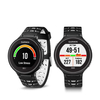
Includes::1 x Forerunner 630 host 1 x USB (Universal Serial Bus) data cable 1 x English application manual ...
Colour: Black
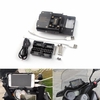
Material: Engineering Grade ABSApplicable model: For BMW R1200GS 2013-2017ADV 2014-2017 For BMW R1200R R1200RS S1000R For XR RR 15-17 Note: No original car navigation bracket models. Need to buy a metal bracket! If the original car has a navigation bracket models, do not need some of the accessoriesdirectly to the mobile phone bracket installed in the original car navigation bracket! Package Included:1 X Mobile Phone Stand 2 X Fixed Boxes 1 X External Power Cord 1 X USB/ Type-C Cable 1 XPipe Clamp 8 X Fittings ...
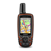
Size: 1.43 x 2.15 (3.6 x 5.5 cm); 2.6 diag (6.6 cm) Display resolution: 160 x 240 pixels Battery life: 16 hours Memory/history: 4GBHigh-sensitivity receiver Interface:high-speed USB (Universal Serial Bus) & NMEA 0183 compatible Maps Memory Basemap Ability to add maps Accepts data cards: micro SD card (not included) Custom POIs (ability to add additional points of interest) Waypoints/favorites/locations: 5000 Routes: 200 Track log: 10, 000 points, 200 saved tracks Sensors Barometric altimeter Compass: Yes (tilt-compensated 3-axis) Outdoor Recreation Features Area calculation Automatic routing (turn by turn routing on roads): Yes (with optional mapping for detailed roads) Geocaching-friendly: Yes (Paperless) Custom maps compatible Hunt/fish calendar Sun & moon information Camera:yes (8 megapixel with autofocus; automatic geotagging) Picture viewer Garmin Connect Garmin Connect compatible (online community where you analyze, categorize & share data) Additional Smart Notifications: yes Live Tracking: yes (with Garmin Connect Mobile) Map segments: 4, 000 Flashlight: yes Package Included:1x GPSMAP 63sc (English version)1x Climbing buckle 1x USB (Universal Serial Bus) Cable 1x Manual ...
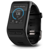
Features: Step Counter Yes Move Bar (Displays on device after a period of inactivity;walk for a couple of minutes to reset it) Yes Auto Goal (Learns your activity level & assigns a daily step goal) Yes Sleep Monitoring (Monitors total sleepand periods of movement or ...
Dimensions (pod in clip)1.5 x 0.9 x 0.8 (37.6 mm x 23.2 mm x 19.2 mm) Weight 12.0g ...
Features:- Garmin Pay contactless payment solution lets you pay for purchases with your watch (available for sup ...
- 56.5 ...
Width: 20mm Weight Sport: 51g; Classic: 48g Band Material Leather ...
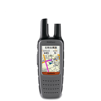
Garmin Rino® 650 GPS Walkie-talkie Interphone Handheld Outdoor
Mountaineering Dedicated Talkback Location Navigator Touc
points of interestSupport navigation mapCompatible tide tableNeed to buy BlueChart chartPackage Includes:1 x Rino 650 host1 x Climbing dedicated buckle1 x MiniUSB data cable1 x Rechargeable lithium battery1 x AC power adapter
- Availability: In Stock
- Supplier: Banggood US
- SKU: 1135682
Product Description
Specification: Size 6.0X 19.0X 4.5 cm Support contour map Display size 2.6 inches Support DEM elevation map Screen Resolution 160240 Supports homemade image maps RAM8 G Additional maps can be added Support for memory cards Micro S Dcard Electronic compass Three axes Weight (with battery)320g Air pressure altimeter Battery specifications Rechargeable lithium battery Track measurement area Battery usage time 14 hours Route measurement area Waterproof indicators IPX7 Position averaging Float Beijing 54, Xian 80, CGCS2000 High Sensitive Receiver Wireless data transmission Interface USBBuzzer sound reminder Number of waypoints 2000 Camera function Route (linepoint)200 x 250 Picture Viewer Track record (point)9999 Photo navigation Save track (linepoints)200 x 10000 Sun & moon astronomy Preloaded with detailed map Support for custom points of interest Support navigation map Compatible tide table Need to buy Blue Chart chart Package
Includes::1 x Rino 650 host 1 x Climbing dedicated buckle 1 x Mini USB data cable 1 x Rechargeable lithium battery 1 x AC power adapter
Reviews/Comments
Add New
Intelligent Comparison
We couldn't find anything!
Perhaps this product's unique.... Or perhaps we are still looking for comparisons!
Click to bump this page and we'll hurry up.
Price History
Vouchers
Do you know a voucher code for this product or supplier? Add it to Insights for others to use.


 United Kingdom
 France
 Germany
 Netherlands
 Sweden
 USA
USA
 Italy
Italy
 Spain
Spain






 Denmark